
This month we feature a great example of how a small school map project can build into something bigger to benefit the community at large. From Bill Cusworth, mapper:
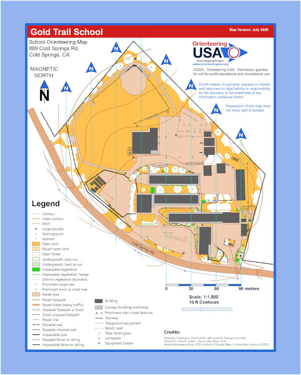
An example of an OUSA Youth Mapping Program (YMP) project that started small and grew into something bigger is the Gold Trail School located near Placerville, California. This project was the very first YMP project to be requested and the first one finished in February 2020. I was the mapper on that project before I joined the YMP committee a few months later as a map consultant. Danny Lulla is the 5th grade teacher who requested the map. He was directed to the YMP program after contacting the local orienteering club, Gold Country Orienteers, based in Sacramento.
After successfully using the school map with his students to teach them orienteering, Danny decided that he wanted to expand his course options by using the area that surrounds the school, Wakamatsu Farm. The farm is a historic landmark, the original site of the Wakamatsu Tea and Silk Farm Colony, established June 8, 1869 , the first Japanese colony in the USA. It is the birthplace of the first Japanese American and contains the gravesite of the first Japanese immigrant buried in the USA.
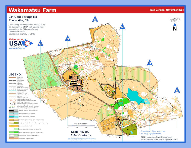
Wakamatsu Farm was too large (1.1 sq km) a project to fall within the scope of the YMP, so Danny secured a $1000 grant from the El Dorado County Office of Education to pay for the new map. Danny asked me to make the map and the map was completed in June 2021 and Danny set about organizing an event there, working with the landowner – the American River Conservancy (ARC).
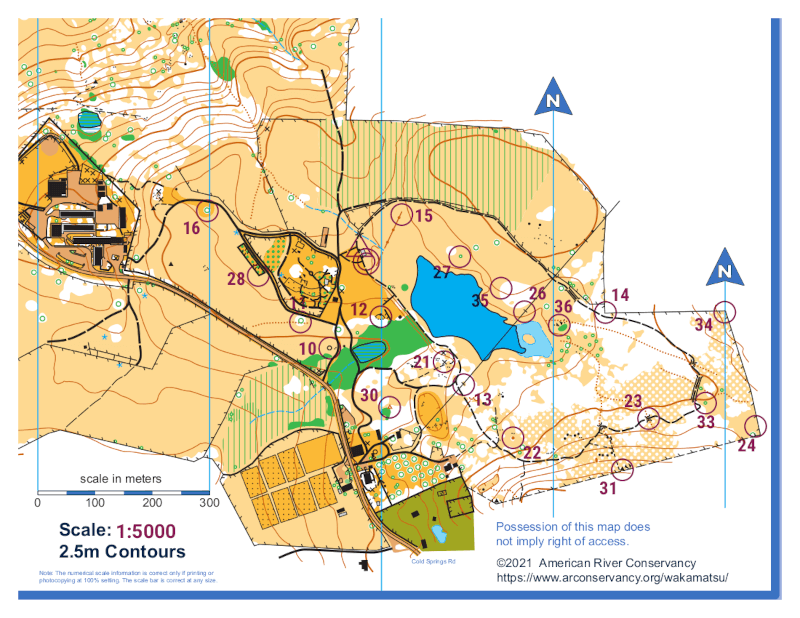
I worked with Danny with some technical details on how to set up an orienteering course. The event took place on December 2 and with 63 fifth graders and was a successful Score-O with 20 controls. ARC has been very receptive to using the land for orienteering and is open to having a public orienteering event in the future. The folks at ARC even produced an introductory video and flyer to help students become familiar with the activity.
The area is suitable for some nice middle distance courses and Gold Country Orienteers will likely hold an event in the future, especially after the map is updated with some brand new LiDAR data.
It all starts with connecting local youth organizations with a local club and through the Youth Mapping Program getting a map made to generate the initial interest in orienteering within the local community. The YMP committee would like your assistance in making these initial connections and is asking you to reach out to the folks you know in your local community – teachers, scout leaders, parks & recreation departments – to let them know about the YMP and how they can get a high quality orienteering map for their organization, often for very little out of pocket cost. YMP maps are the seeds for growing a new generation of orienteers, help us spread these seeds by suggesting it to contacts in your own local community.


Photos courtesy Danny Lulla.
Application for YMP Map.