YMP May Map of the Month
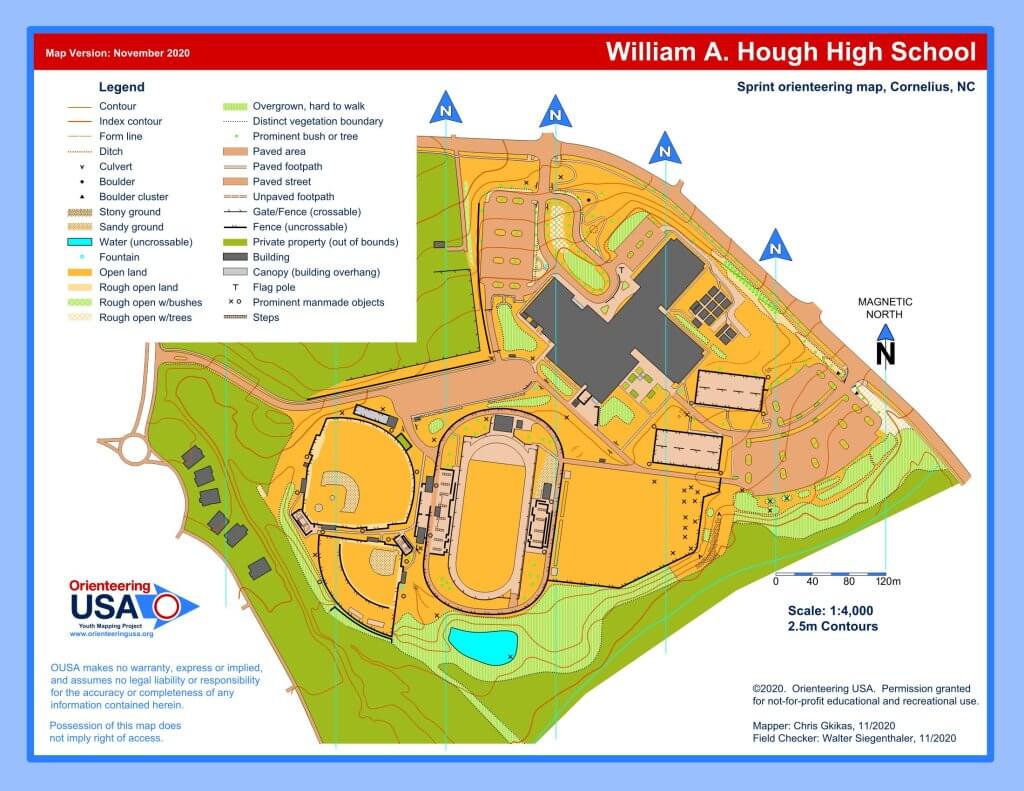
The Youth Mapping Program May Map of the Month is William A. Hough High School in Cornelius, NC.
In addition to its use in physical educaton classes and for orienteering activities, teachers at the school hope to use this map for scenario-based learning experiences, such as first aid trainings. “This [map] makes planning for orienteering classes much easier, more realistic, and significantly more fun.”
Are you interested in having a map made of your school, camp, or youth-serving organization? Learn more about the program and apply here.